")
PhD Dissertation:
AVAKOUDJO Julien (2016). Dongas assessment: Processes, Management and valorized Opportunities in Karimama District (Northern Benin). Faculty of Agronomic Sciences. Department of Natural Resources Management, UAC, Benin.
Promotor : Professeur Brice Augustin SINSIN.
ABSTRACT: The northern Benin is marked by serious economic and environmental problems due to the « Dongas » and soil erosion, especially in the basins of Alibori and Mekrou in the W National Park and its periphery. The aim of the thesis was to gain a better understanding on the processes and mechanisms of erosion and dongas phenomenon on the one hand, and to identify high value local species in another hand, taking into account their socio-economic and cultural importance in Karimama district in order to develop better rehabilitation strategies of degraded ecosystems.
This work assesses, first of all, the land use dynamics in the W National Park and its periphery throughout diachronic analyses of Landsat images from 1972, 1990 and 2008. Results indicated regressive forest and savanna formations in favor to agricultural lands mainly driven by demography, agriculture and overgrazing. Soil erosion is one of the most recurrent physical degradation of these ecosystems.
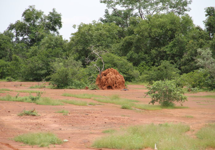
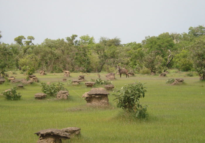
The W National Park and its periphery are mostly marked by the dominance of “dongas“. The spatial distribution of this phenomenon was evaluated in Chapter 2 and lead to the dongas inventory and classification. More dongas exist in the Park than in its periphery (i.e. 63.41% versus 36.59%). The dongas settled on six characteristics of ferruginous soils. The most susceptible are the washed and hydromorphic soils with respectively 52.04% and 35.71% of dongas.
The relationships between the mechanisms leading to the dongas formation and development, anthropogenic as well as natural drivers were questionable. Several methods i.e. individual and group interviews, field observations, measurements of soil water infiltration, textural discontinuity as well as the dongas morphological and physico-chemical characteristics were used. Globally, dongas formation results from the interaction of anthropogenic (leading to land cover destruction) and naturals (climat and soil) causes and factors. The dongas development was found to be linked to regressive erosion; the clay load and bulk density increasing in the underlying horizons as a result of textural discontinuity with the collapse of soil in the Park and its periphery. This textural discontinuity is observed at 83.87% of soil profiles.
The assessment of the rainfall from 1970 to 2014 and rainfall erosivity derived from Universal Soil Lost Equation (USLE) and the Modified Fournier Index (MFI) shown seasonal distribution of rainfall during 24 years (53% of individual years) and strong seasonal effect during 19 years (42% of individual years) with increasing values during 45 years period indicating monthly rainfall concentration. Rainfall aggressiveness is high during 7 years (16% of individual years) while 38 years (84% of individual years) have very high aggressiveness. Rainfall erosivity ranged in the medium-strong erosivity and was observed during 39 years (87% of individual years). Monthly rainfall amount is more significantly related to the rainfall erosivity with power regression at Kandi station.
The effect of erosion on physico-chemical soil properties in degraded areas (dongas) in W National Park and its periphery shows that water erosion began with the selective removal of fine soil particles. It significantly affects the bulk density and porosity of the soil. In addition, organic matter (OM) contents in the soil were extremely low. Although the extent of erosion did not significantly affect the OM contents, but it significantly reduces the soil cationic capacity exchange and induces a loss of soil metal cations (especially Ca 2+).
As far as the restoration actions were concerned, local species of high value taking into account their socio-economic and cultural importance were identified. Vitellaria paradoxa, Parkia biglobosa, Borassus aethiopum, Sclerocarya birrea and Tamarindus indica were indicated mostly for land restoration and farmers income improvement while Piliostigma reticulatum was specifically mentioned for soil fertility restoration. Ficus sycomorus, Khaya senegalensis, Balanites aegyptiaca, Afzelia africana and Albizia chevalieri were pointed as pasture. For restoration actions implementation in the Park and its periphery, the growth abilities of five plant species among those proposed by locals (Parkia biglobosa, Moringa oleifera, Khaya senegalensis, Jatropha curcas and Balanithes aegyptiaca) have been tested under two techniques of water and soil conservation (half-moon and Zaï) in dongas. The half-moon was proved to be the best while the Zaï was easily achieved by farmers. Jatropha curcas and Balanites aegyptiaca showed better survival rates and growth in diameter and height at the juvenile stages after fourteen weeks. Their adoption in developing sustainable strategies for the restoration of degraded areas in Northern Benin requires further dry season data.
Keywords: Dongas, erosion, periphery, W National Park, soil and water conservation techniques, Benin.